Over the past 25 years, State Wildlife Action Plans have evolved from foundational blueprints into comprehensive, science-based strategies that address a broader range of species, regional priorities, and conservation challenges. Since the establishment of the State Wildlife Grants program in 2000, every state has updated its plan on a regular cycle, with the most recent revisions completed in 2025.
In parallel, the GIS tools supporting these efforts have transformed how conservation work is planned, implemented, and communicated. Bringing State Wildlife Action Plans from strategy to action depends on collaboration among diverse partners and stakeholders. Modern Web GIS supports this work through shared data, visualization, and storytelling, using tools such as StoryMaps, Dashboards, and ArcGIS Hubs to communicate complex science and policy in clear and compelling ways.
This webinar series explores how advances in conservation science, policy, and spatial technology collectively shape today’s State Wildlife Action Plans. Participants will hear from state agency biologists and practitioners and will learn best practices for connecting expanded biological scope with holistic GIS strategies to support implementation, collaboration, and communication.
Part 1: March 17, 2026
Sunny Fleming, Director - Conservation Solutions, Esri, and John Kanter, Senior Wildlife Biologist, National Wildlife Federation, will consider the evolution of State Wildlife Action Plans and a greater need for collaboration across ecosystems, and how GIS has and can continue to contribute to advancing communication, data collection, and demonstrating the impact.
Part 2: April 28, 2026
Since the establishment of the State Wildlife Grants program in 2000, every state in the nation has created a blueprint of conservation actions for wildlife. These State Wildlife Action Plans are required to be updated every ten years with October 2025 the most recent version. Join Naomi Edelson, Senior Director, and John Kanter, Senior Wildlife Biologist, National Wildlife Federation, as they share an overview showcasing the inclusion of plants, insects, and regional priorities to ensure the recovery of the full diversity of flora and fauna, and how you can support the implementation of your state’s action plan.
Part 3: May 12, 2026
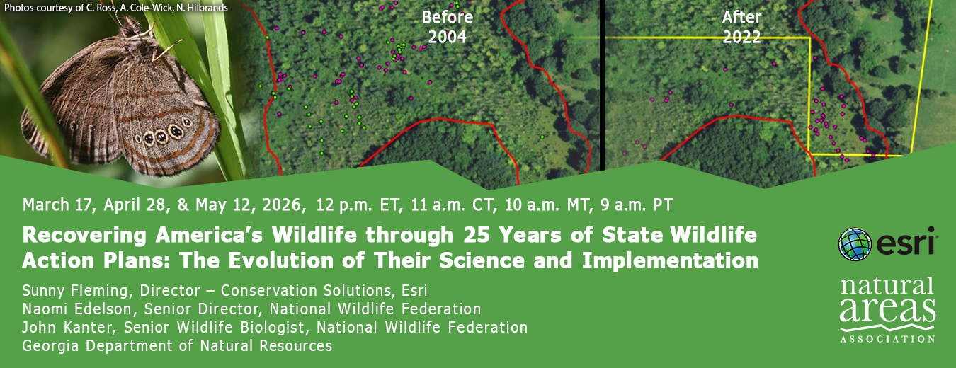
The third webinar will feature your peers from the Georgia Department of Natural Resources who are using Esri's GIS tools to support planning efforts such as State Wildlife Action Plans. Modern Web GIS supports this work through shared data, visualization, and storytelling, using tools such as StoryMaps, Dashboards, and ArcGIS Hubs to communicate complex science and policy in clear and compelling ways. This program is practical and applied, offering real-world insights you can apply to your own work.
| 4/28/2026 | |
Support the people who manage our natural areas and protect biodiversity in perpetuity.